There are several settings you can change on the map, regardless if you're exploring a project, an organization or just generally scrolling through the map. These settings are usually predefined for each project by its members, but can be changed by a visitor in the frontend. These changes are personal and won't affect what other visitors see, when visiting the same project.
To open the Base Map settings click on the "Globe" icon on the top right of the map.
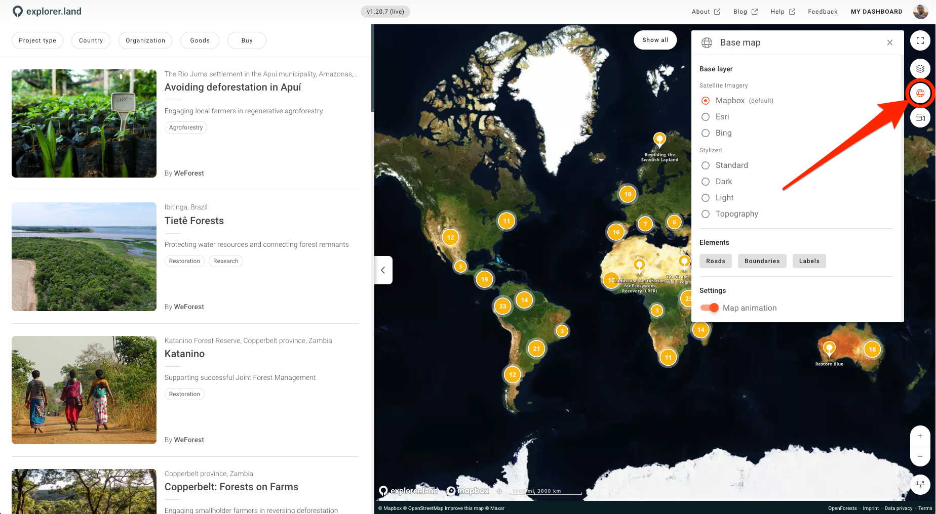
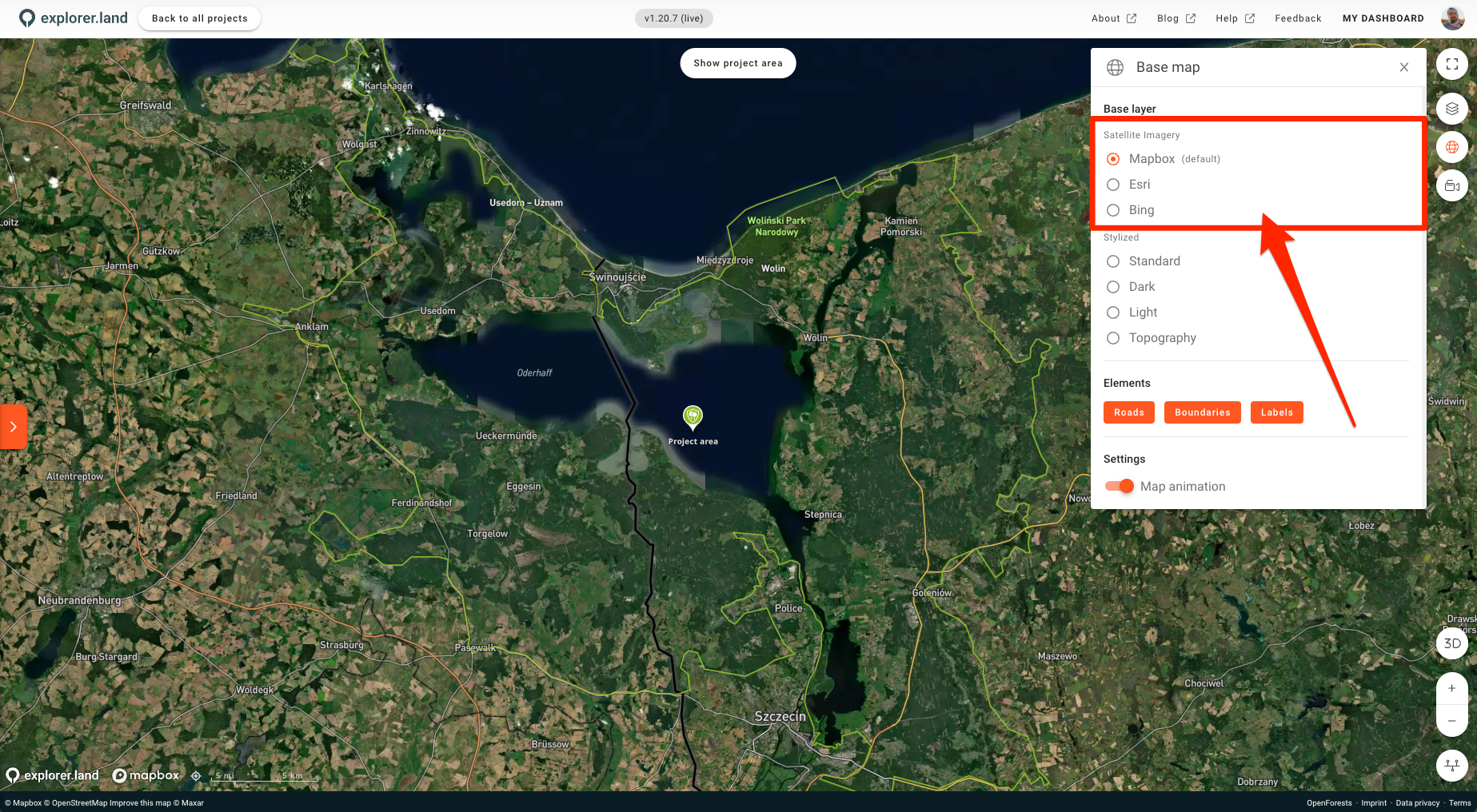
Satellite Imagery
You have 3 satellite providers to choose from, Mapbox, which is also the defauld base map of explorer.land, Esri and Bing. Although these satellite maps don't have a date indication of when they were made, it might be useful to change them for other reasons, like cloud cover.
To change provider just click on it.
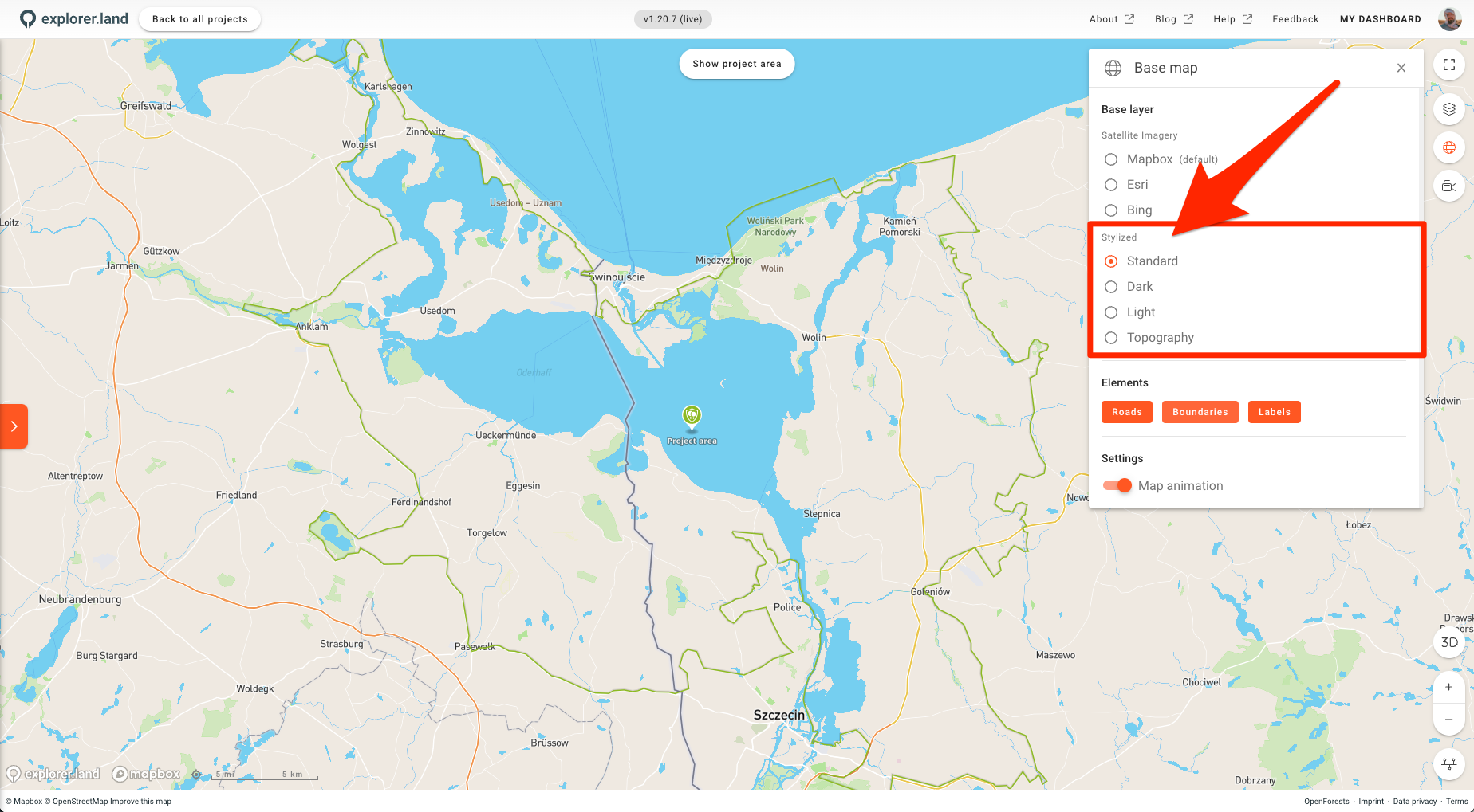
Stylized
You also have the option to use a stylized map layer. You can choose from Standard, Dark, Light and Topography.
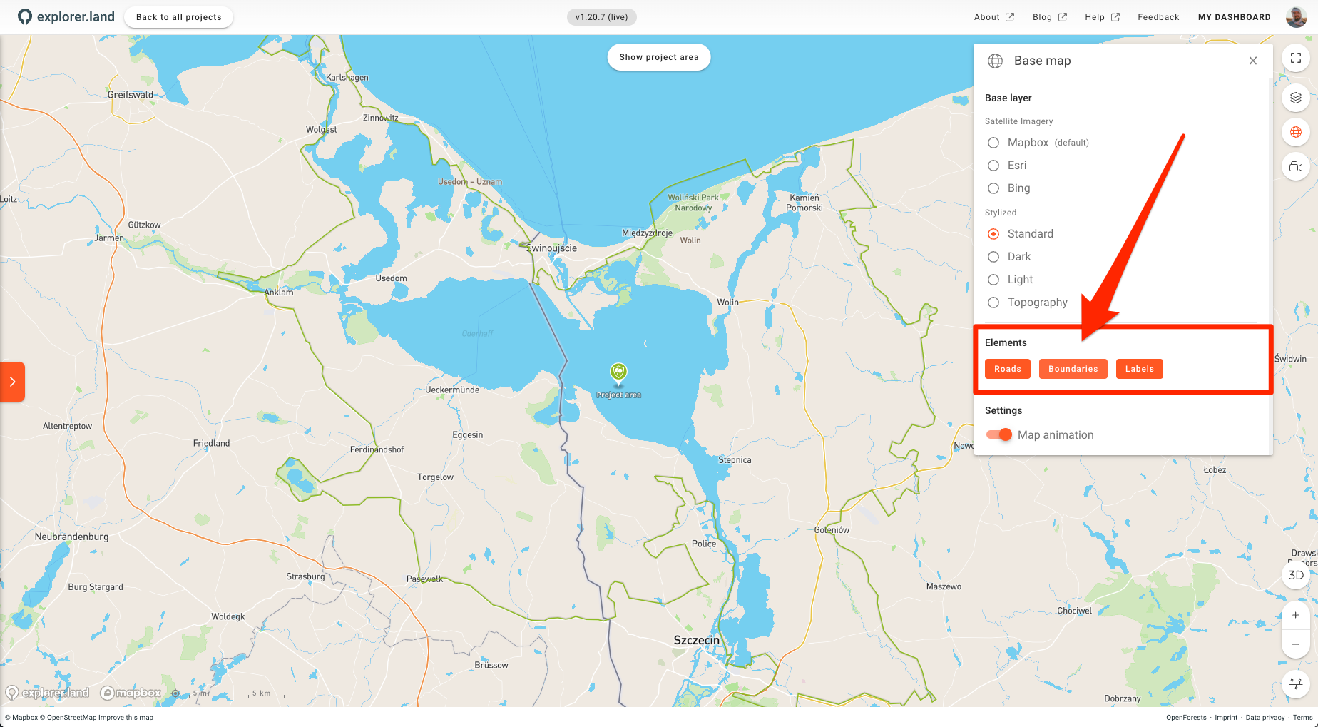
Elements
Under Elements you are able to turn on and off the Roads, Boundaries and Labels on any map. Click on one of them to activate/deactivate.
Settings
Under Settings you are able to turn on or off the Map animation. This animation in form of a zoom-in to the map location happens each time you click a marker on the map, be it a Project, a Site or a News Post (also when clicking on a geolocated item on the left content bar). Turn of the Map animation to directly be taken to the location without any map movement.