It is possible to create several Sites at once by uploading a vector file containing points or polygons. This allows populating your Site list with entries without having to create each Site individually.
Requirements
The vector file containing points or polygons must be in the geojson format. Learn how to convert your vector file into a geojson file here.
Procedure
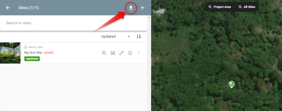
In your Project overview page open your Sites list.
To initiate the mass upload process, click on the 'upload' icon on the top right of your Sites list.

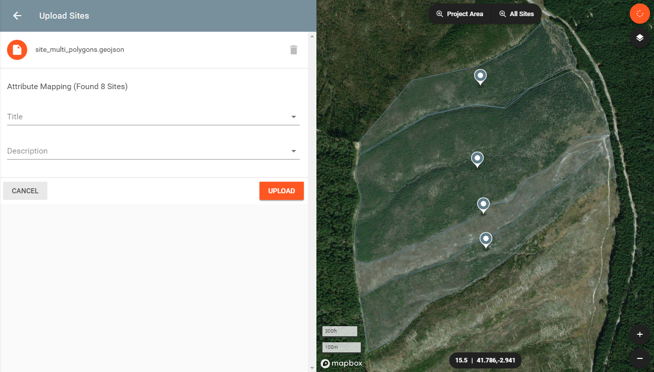
And again on the 'file' icon to select your geojson file.

Once you have selected the file and no problems occur (format incompatibility, geographic inconsistencies, etc.), you will be shown a preview on the map where the Sites are located. This allows you to confirm that you have selected the correct data.

Importing values from the attribute table
It is possible to populate the Site fields Title and Description by directly importing values available in the file's attribute table, shortening the edition of the respective fields of each individual Site later on.
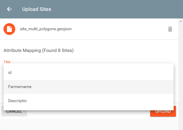
Choose which attribute column you want to map onto the fields Title and Description by selecting it from the drop down list.

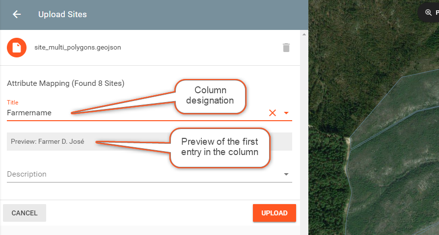
After selecting an attribute column, you will see a preview of the value of the first entry of the table.

You may also leave one or both fields empty. No import will take place for those fields.
Uploading
Once you have confirmed that all data is correct, click *UPLOAD to finalize the import process. Depending on the amount of Sites to be generated, this might take a few seconds.
As soon as the import process has ended, you will see the newly created Sites listed on your Site list set to draft. You may now edit and/or publish each Site individually.
